 Direct mail notices
 Project website
 Technical review agencies consultation
 Newspaper notices
 York Region social media (Facebook, X)
 Online
survey
Online
survey
 Online open houses
 Stakeholder consultation
Rail crossing safety
- Level rail crossing is dangerous for cyclists
- Impatient drivers on the tracks between the rail crossing gates
- Emergency services are delayed with current congestion and train crossings
Elgin Mills Road / CN Railway Crossing (Yonge Street to East of Newkirk Road) City of Richmond Hill
Welcome to the second Online Open House for the Elgin Mills Road / CN Railway Crossing Environmental Assessment (EA) Study.
The reviewing and commenting period for Online Open House #2 is open from Monday, March 11 to Monday, April 1, 2024.

Share key feedback received to date
Present the design approach, alternatives considered, evaluations and preliminary recommendations for the project
Present the recommended preferred preliminary design
Obtain your input about the project
Next steps
Please note your personal information (e.g. name, address, and phone number) is collected, maintained, and disclosed under the authority of the Environmental Assessment Act and the Municipal Freedom of Information and Protection of Privacy Act for transparency and consultation purposes.
Personal information submitted will become part of a public record that is available to the general public unless it is requested that the personal information remain confidential.
York Region is undertaking a transportation Environmental Assessment (EA) Study for improvements to Elgin Mills Road between Yonge Street and east of Newkirk Road, in the City of Richmond Hill.
An Environmental Assessment (EA) is a planning and approval process for municipal infrastructure projects, legislated by the Ontario Environmental Assessment Act. This study is being conducted as a Schedule ‘C’ project under the Municipal Class EA document (2023) and incorporates the Region’s Transportation Master Plan (TMP) process. Public consultation is a key component of the EA process.
The study is currently in Phase 3 – Alternative design concepts for the preferred solution of the EA process.
The first Online Open House (OH1) was held from Thursday, January 27 to Thursday, February 17, 2022 and saw 433 participants. The number of responses received varied per question.
Percentage of respondents that agree with the recommendation
Percentage of respondents that indicated a preference for active transportation facility type
The EA study is anticipated for completion in 2024. An Environmental Study Report (ESR) will document the study’s decision-making rational and consultation process and be made available for public review at the completion of the study.
The detailed design stage will follow and take two to three years to complete (2024-2027). During detailed design the Region will finalize the design and property requirements, purchase required property, apply for and obtain all necessary permits and complete utility relocations. Construction drawings and documents will be prepared.
The Region’s 2024 10-year Roads and Transit Capital Construction Program identifies construction commencing in 2028. Construction is anticipated to take two to three construction seasons to complete. A detailed construction schedule will be prepared during detailed design.
The timing of improvements is subject to annual review and can change.
Preliminary cost estimates will be developed following this Online Open House, after the recommended design is confirmed and refined. Construction will largely be funded through development charges with a lesser portion paid through the tax levy.
Following Online Open House #1, the preferred solution for the Elgin Mills Road / CN Railway Crossing was confirmed. The preferred solution is to construct a rail grade separation structure that separates the road from the railway and accommodates active transportation along the Elgin Mills corridor. This will:
With the preferred solution confirmed, the next step was for the project team to develop and evaluate different design alternatives. The design alternative development, evaluations and recommendations determined how to best separate Elgin Mills Road from the level rail crossing, accommodate pedestrians and cyclists, and support all travel modes.
The following technical studies are in progress or completed to inform the development of the design alternatives, evaluations and impact assessment of the proposed improvements:
The following criteria was used to assess the alternative design concepts:
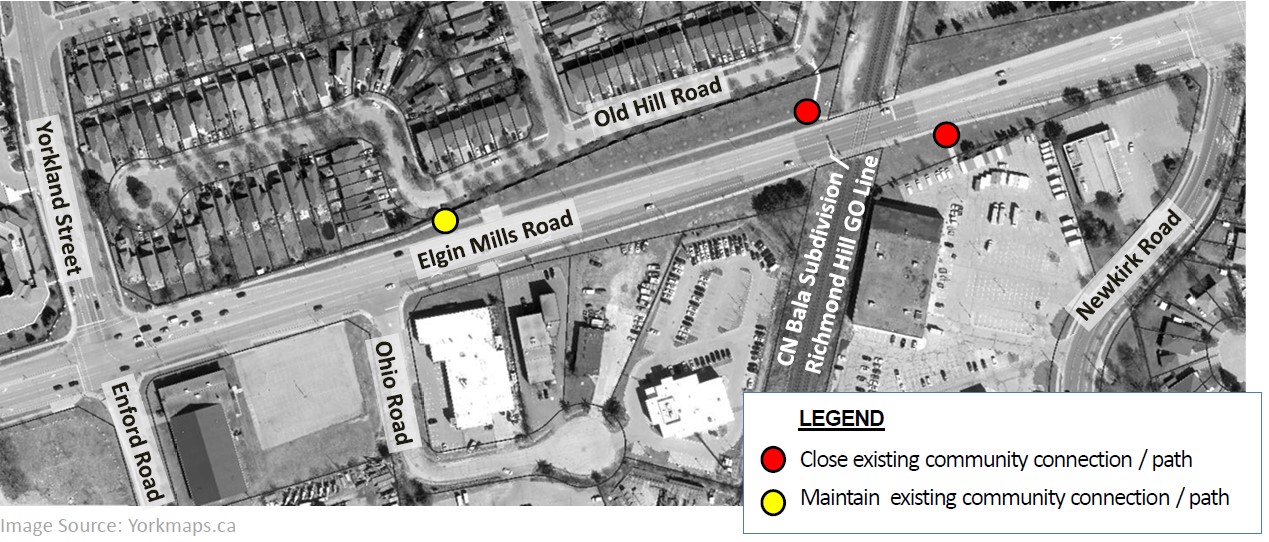
Image Source: Yorkmaps.ca
Rail corridor is currently serviced by CN Freight Rail, CN Corridor Maintenance, GO Commuter Rail and VIA Commuter Rail
Vehicles are delayed at the crossing as they are required to stop for trains to cross, causing driver frustration – safety concerns for motorists due to potential conflicts with crossing trains
Increased train frequency is expected and lengthy duration of train crossings (e.g., freight trains)
Vehicle queues extend to adjacent intersections when crossing arms are lowered for passing trains
Safety concerns for pedestrians at the existing CN Railway crossing
Elgin Mills Road does not support cycling facilities at the crossing
To determine how to best separate Elgin Mills Road from the level rail crossing and accommodate pedestrians and cyclists, the following alternative designs were considered and evaluated.
Elgin Mills Road crosses the CN rail tracks at the existing level crossing.
Existing Elgin Mills Road at-grade crossing East of Yonge Street.
Not carried forward
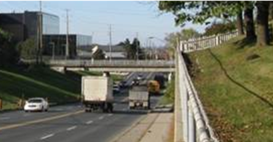
Elgin Mills Road is lowered under the CN rail tracks.
Underpass example:
Major Mackenzie Drive east of Keele Street.
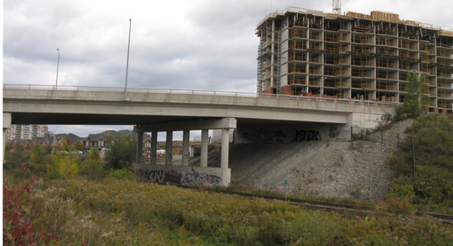
Elgin Mills Road is raised above the CN rail tracks.
Overpass example:
Bantry Road east of Yonge Street.
Not carried forward
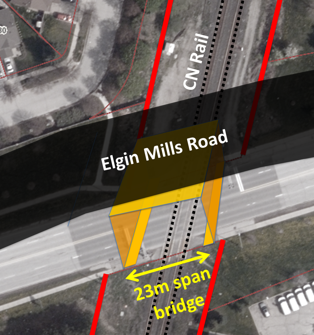
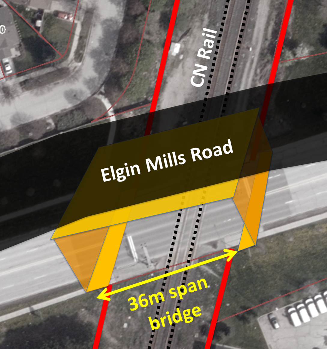
CN is a critical stakeholder in the success of this project. The existing CN Rail right-of-way (ROW) is 36 metres with two existing railway tracks. CN have confirmed that while they currently have no plans for future rail expansion, they would like to protect their ROW for future expansion. The project team, in consultation with CN Rail, reviewed two main bridge alternatives for crossing the railway tracks:
With this option, bridge abutments are proposed inside the CN Rail right-of-way. This option would accommodate the two existing railway tracks plus one additional railway track for future expansion and would meet all railway clearance requirements.
Overpass bridge carrying Elgin Mills Road spans the full 36 metres CN right-of-way. With this option, bridge abutments are proposed outside the CN Rail right-of-way. This option would accommodate the two existing railway tracks and would not restrict any future rail expansion within CN’s right-of-way. CN being a key stakeholder, the Region has throughout this study, consulted with CN on alternatives for the grade separation. This option was created in response to CN concerns regarding the placement of abutments within the CN ROW. The agency has indicated that in consultation with other Rail Authorities/Stakeholders, would not support an option that has infrastructure located within their Rail ROW, limiting their ability to expand in the future.
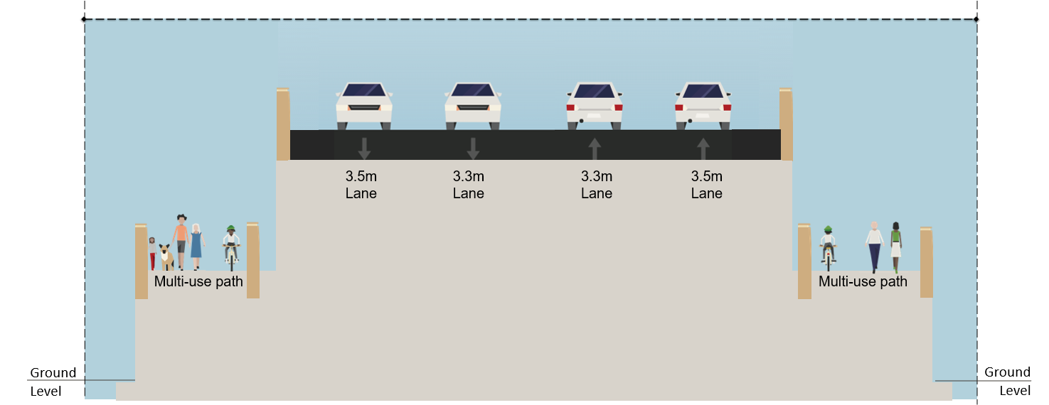
Both options maintain the same roadway cross section over the railway tracks (i.e. four lanes of traffic, multi-use path on both sides of the road). However, Option B results in a larger bridge with more impacts and a longer construction duration. A detailed evaluation of both options is provided.
| CRITERIA |
Overpass Alternative A – Partial Span (23 metres) |
Overpass Alternative B – Full Span (36 metres) |
SUMMARY |
|---|---|---|---|
| TRANSPORTATION SERVICES | |||
|
Most preferred | Most preferred | Both alternatives are ranked as most preferred under transportation services as there is no difference amongst the alternatives. Both alternatives maintain four travel lanes along Elgin Mills Road and accommodate dedicated and continuous active transportation facilities over the rail crossing. |
| NATURAL ENVIRONMENT | |||
|
Most preferred | Most preferred | Both alternatives are ranked as most preferred under natural environment as there is no / marginal difference amongst the alternatives as both alternatives will have a similar impact to the natural environment. |
| SOCIAL ENVIRONMENT | |||
|
Most preferred | Less preferred |
Both alternatives improve access and reduce congestion, have similar property impacts without requiring property from residential lots, and provide opportunities for additional street plantings and landscaping screening buffers to improve the visual aesthetics of the corridor. Alternative A - Partial span (23 metres) is ranked as most preferred under social environment as the highest point of the overpass structure is slightly lower than in Alternative B – Full Span (36 metres), resulting in a reduced visual obstruction from the overpass west of the rail corridor. |
| INFRASTRUCTURE DESIGN AND ECONOMIC ENVIRONMENT | |||
|
Most preferred | Least preferred |
Both alternatives have similar utility impacts, property requirements and relocation requirements. Both alternatives also require re-grading of the Apotex Entrance and raises Newkirk Road at its intersection with Elgin Mills Road. Alternative B -Full span (36 metres) would accommodate the two existing railway tracks and would not restrict any future rail expansion within CN’s right-of-way (CN have confirmed that while they currently have no plans for future rail expansion, they would like to protect their ROW for future expansion). For this alternative, bridge abutments are proposed outside of CN’s right-of-way. When compared to Alternative A –Partial span (23 metres), Alternative B -Full span (36 metres) has greater capital, operating and maintenance costs to account for the larger bridge structures to span the full CN right-of-way, and will result in a longer construction duration. Alternative A - Partial span (23metres) is ranked as most preferred under infrastructure design and economic environment. This alternative would accommodate the two existing railway tracks plus one additional railway track for future expansion and would meet all railway clearance requirements. For this alternative, bridge abutments are proposed inside CN’s right-of-way. This alternative requires smaller bridge structures and will have lower capital, operating and maintenance costs, and reduced construction duration compared to Alternative B – Full span (36 metres). |
| OVERALL SUMMARY | |||
| RECOMMENDATION |
Technically preferred but not carried forward Not supported by CN |
RECOMMENDED | |
This alternative meets the study requirements, requires smaller bridge structures requiring a shorter construction duration, creates a lesser visual impact/obstruction, and has lower costs compared to Alternative B – Full span (36 metres). Although this alternative protects for some future rail expansion (up to one additional track), it limits CN’s ability to maximize future rail expansion within the rail right-of-way, and requires construction of bridge abutments within the CN Rail right-of-way. This alternative is not supported by CN Rail and is not carried forward.
Although this alternative requires larger bridge structures with a longer construction duration, creates a greater visual impact/obstruction, and has higher costs compared to Alternative A – Partial span (23 metres), CN Rail is supportive of Alternative B – Full span (36 metres). This alternative meets the study requirements, does not require the construction of bridge abutments within CN’s right-of-way, and does not restrict any future rail expansion within CN’s right-of-way.
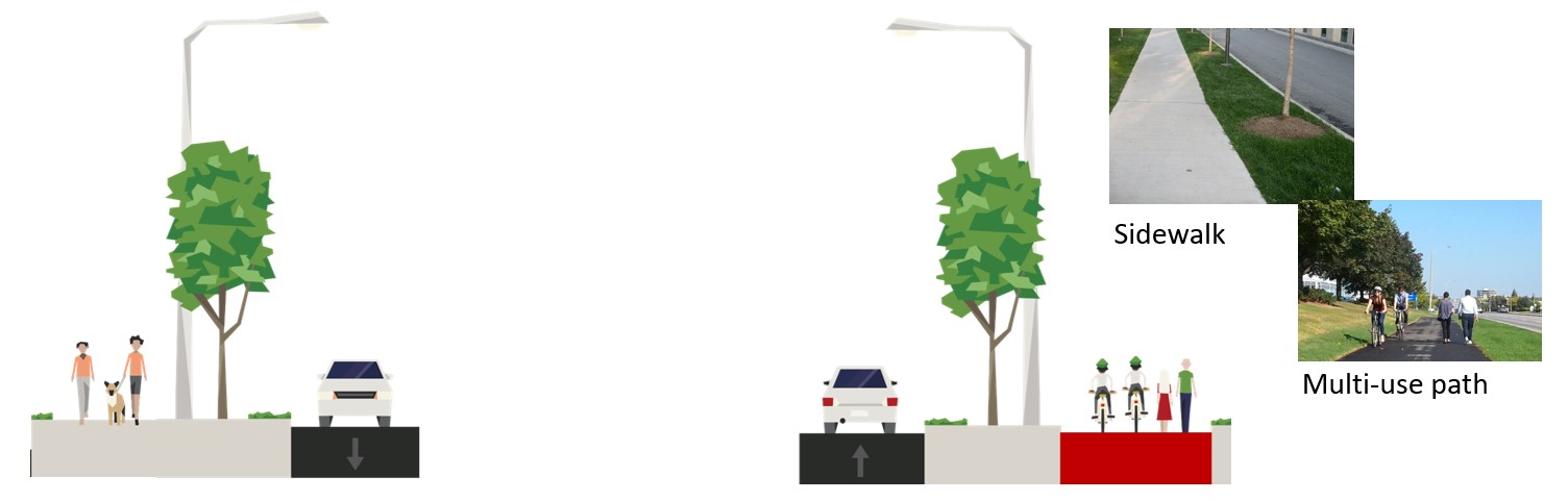
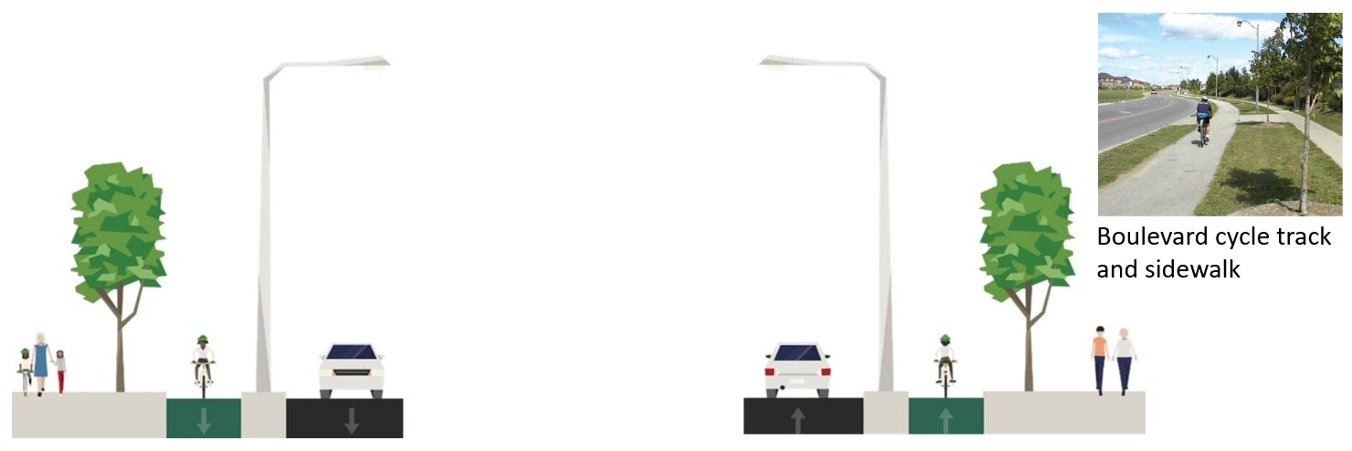
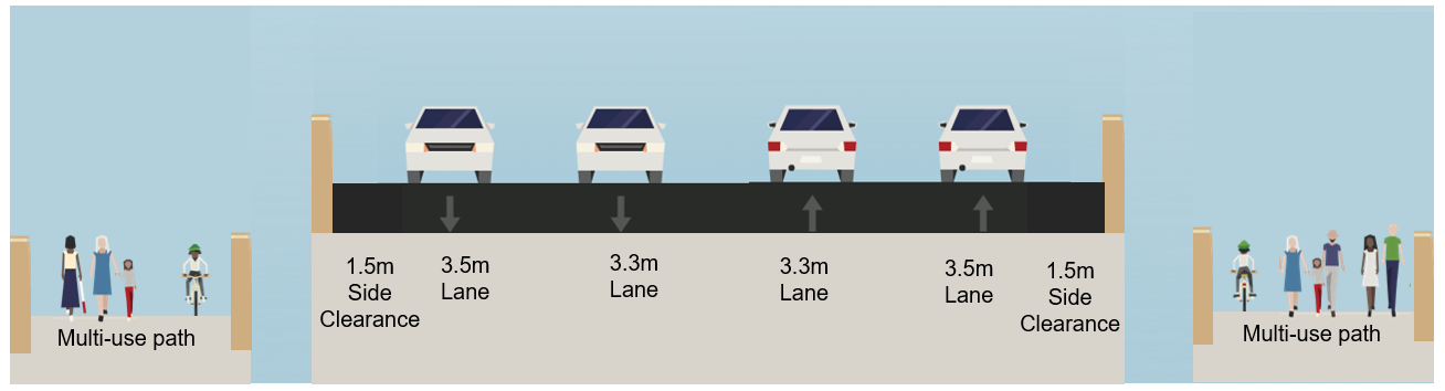
Currently there are sidewalks located on the north and south boulevards and no cycling facilities along Elgin Mills Road.
To determine how to best accommodate pedestrians and cyclists along Elgin Mills Road between Yonge Street and east of Newkirk Road the following active transportation alternative designs were considered and evaluated.
Elgin Mills Road crosses the CN rail tracks at the existing level crossing.
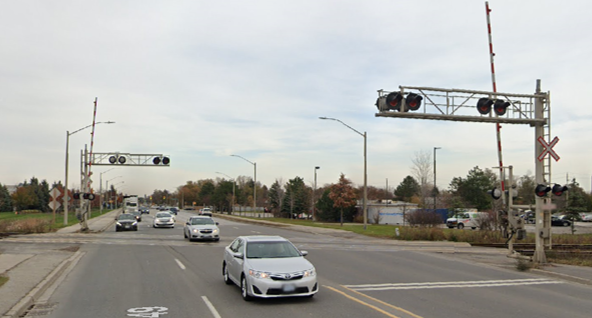
Elgin Mills Road is lowered under the CN rail tracks.
Elgin Mills Road is lowered under the CN rail tracks.
Overpass bridge carrying Elgin Mills spans 23 metres of the CN Rail right-of-way. Bridge abutments are constructed inside the rail right-of-way.
Overpass bridge carrying Elgin Mills spans the full 36 metre CN Rail right-of-way. Bridge abutments are constructed outside the rail right-of-way.
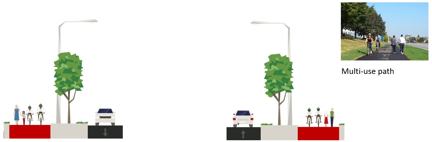
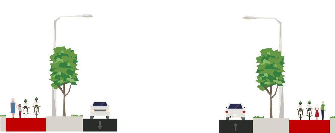
Sidewalk one side, multi-use path other side
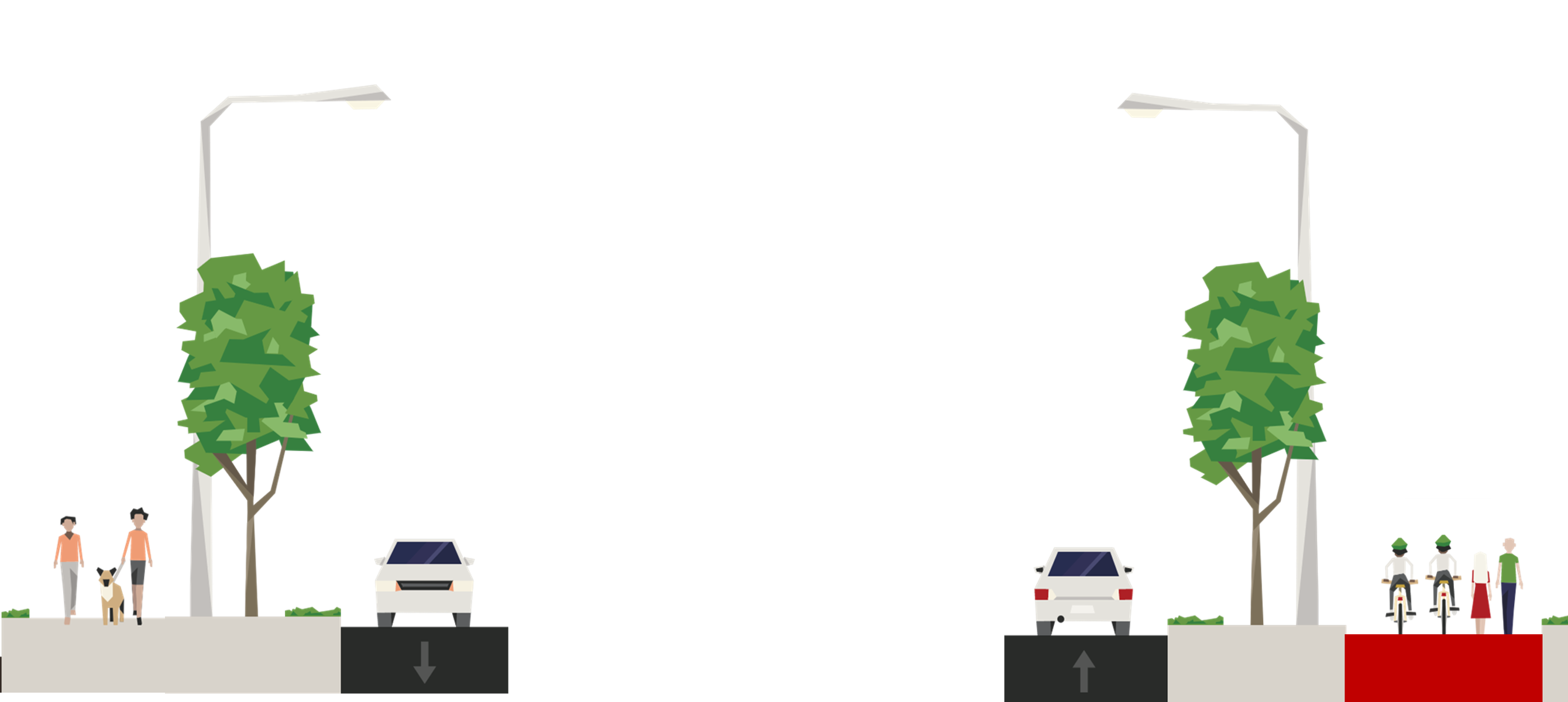
Sidewalk and separated boulevard cycle tracks on both sides
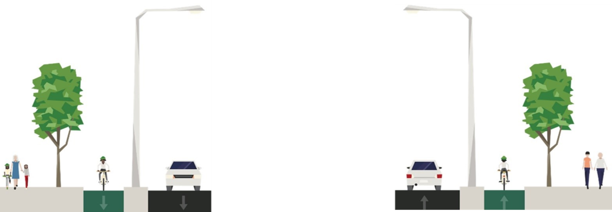
Multi-use paths on both sides of the road
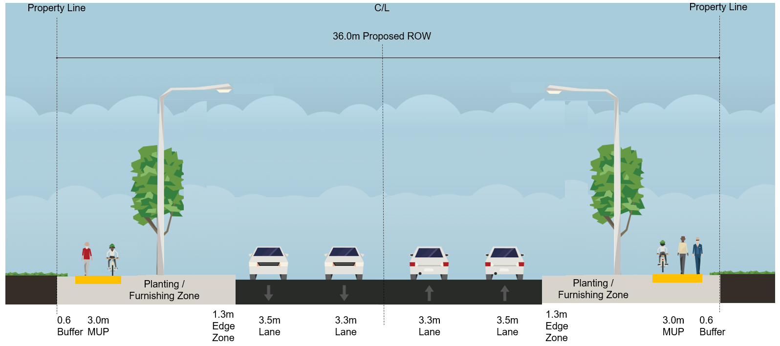
Typical Section of Elgin Mills Road (at-grade level)
Typical Section of Overpass (Elgin Mills Road, grade raise approaching rail corridor)
Typical Section of Overpass Bridges At Rail Crossing (Elgin Mills Road Bridge and Two Active Transportation Bridges)
Crossrides are proposed at signalized and unsignalized intersections to provide increased visibility and dedicated space to accommodate pedestrian and cyclist crossings.
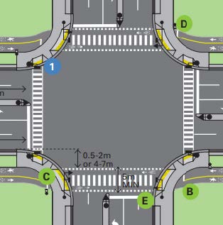
Image Source: York Region Planning and Design Guidelines for Pedestrian and Cyclist Facilities, Figure 5-7
The overpass will require the closure of two existing community paths / connections. Pedestrians and cyclists will need to access the proposed multi-use paths from the Newkirk Road intersection and Old Hill Road community connection.
A noise impact assessment study was conducted to determine the noise levels from future traffic along Elgin Mills Road between Yonge Street and east of Newkirk Road because of the proposed overpass.
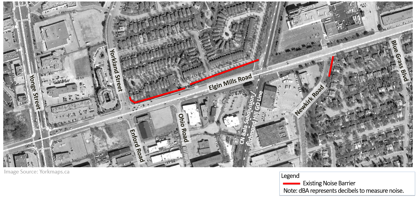
Image Source: Yorkmaps.ca
Noise mitigation (construction of new noise barriers) is not recommended as a result of the proposed improvements to Elgin Mills Road
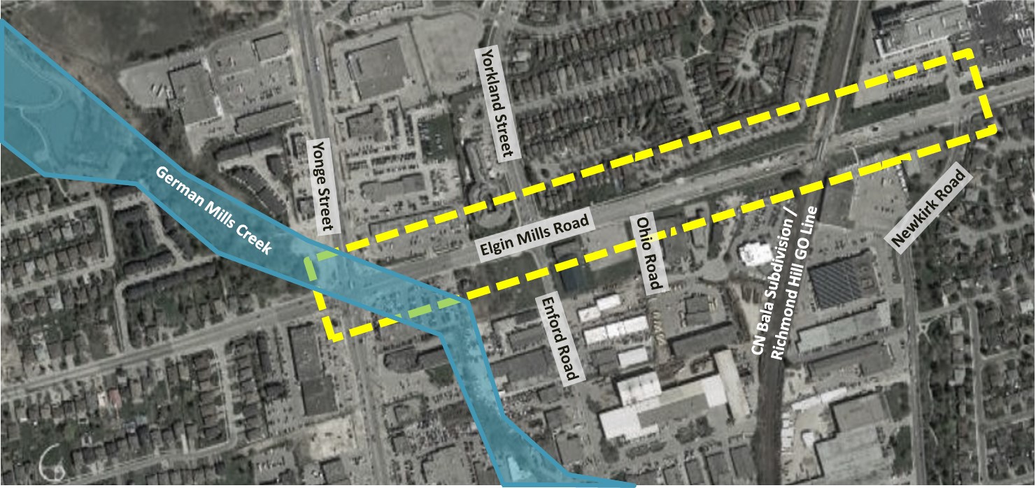
Image Source: Google Maps
German Mills Creek crosses Elgin Mills Road at its intersection with Yonge Street.
Improvements to the German Mills Creek crossing at the Elgin Mills Road / Yonge Street intersection were determined through the City of Richmond Hill’s Flood Remediation Study, completed in 2016. The study identified a preferred design to remediate existing surface flooding in the area of Yonge Street and Elgin Mills Road flood vulnerable area. At the Elgin Mills Road / Yonge Street intersection, the study recommended the installation of a 5-metre-wide box culvert to accommodate German Mills Creek.
The recommendations from the City’s 2016 Flood Remediation Study at German Mills Creek crossing are incorporated in this Elgin Mills Road / CN Railway Crossing EA study.
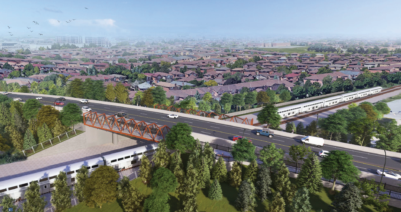
The overpass design raises Elgin Mills Road over the Richmond Hill GO Rail corridor. Elgin Mills Road will gradually rise east of the Ohio Road intersection, with its highest point west of the rail corridor and then gradually descend back to the existing ground level at the Newkirk Road intersection. Separate active transportation (AT) bridges are proposed on both sides of the road to carry the multi-use paths over the rail corridor. The two separate AT bridges will be constructed at a lower elevation than Elgin Mills Road to allow for a more gradual incline for pedestrian and cyclist travel.
To obtain future CN Railway permits and approvals for construction, the recommended design for the bridges are planned to span the full CN railway right-of-way. The Region has consulted with CN Rail, the City of Richmond Hill and the Toronto Region and Conservation Authority (TRCA) on the recommended design of the overpass.
The overpass design will create a visual obstruction due to its proposed height. To improve the visual aesthetics of the corridor, an enhanced landscaping design is proposed. It includes landscaping and street trees along both boulevards to reinstate lands used for the temporary detour road during construction.
The 2022 Regional Transportation Master Plan (TMP) Map 3 - 2051 Rapid Transit Network and the 2022 Regional Official Plan Map 10 - Rapid Transit Network identifies a “GO Rail Station subject to further study” at Elgin Mills Road along the Richmond Hill GO Rail Line. The need for a future GO Station at this location is subject to a separate study and is not within the scope of this EA.
As there is insufficient information at this time regarding the potential for a future GO station at Elgin Mills Road, the recommended design for Elgin Mills does not preclude a future GO station.
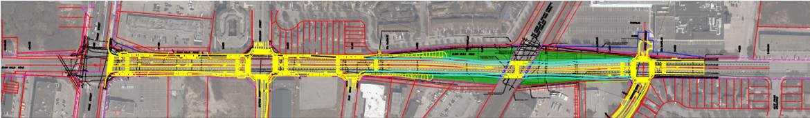
Click on the image to view the recommended design plan and profile drawing along Elgin Mills Road from Yonge Street to Newkirk Road.
Click on the image to view renderings of the overpass and the proposed landscape design.
Review feedback from the public
Refine and confirm recommended design concept
Document study findings
File the Environmental Study Report (ESR) for a public review period
Timing of improvements for Elgin Mills Road is identified in the Region’s 2024 10-Year Roads and Transit Capital Construction Program and is subject to annual review.
The current recommendation is for construction to commence in 2028.
Please provide any additional comments on the Elgin Mills Rd / CN Railway Crossing EA study by entering them below or contact us by email or phone by April 1, 2024.
York Region, Public Works
For more information visit us at: york.ca/ElginMillsStudy.